May 13, 2017
Dundas Valley Conservation Area is located in Dundas, Ontario. The 1,200 hectares provides visitors with access to 40 kms of trails which are maintained by the Hamilton Conservation Authority. Three major trails are at the centre of the trail system – the Main Loop Trail, Bruce Trail, and Hamilton to Brantford Rail Trail. There are also picnic areas available to enjoy, the Trail Centre (a replica of a Victorian train station), the Hermitage Ruins, and the Discovery Centre (located within the trail centre).
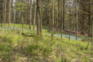
Dundas Valley was formed by glaciers which retreated from the area over 10,000 years ago. The landscape has continued to be shaped by the glacial melt water and most recently by streams forging their paths throughout the valley floor. The Carolinian forests, meadows, streams and geological formations that make up the conservation area are home to rare plant species, as well as many birds and animals.
Click here to view map of Dundas Valley Conservation Area
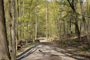
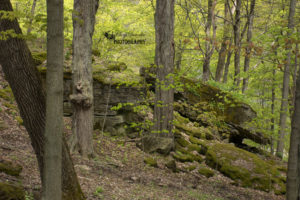
On the day I visited Dundas Valley Conservation Area, I parked in the main lot and headed in the direction of the Trail Centre. Once I had reached the trail centre, I checked my map and decided to begin my hike on the main loop trail. After I had been walking for a little while I came upon the Hermitage Ruins and decided this would be a good spot to take a quick break.
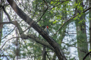
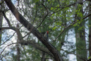
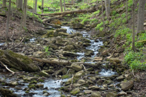
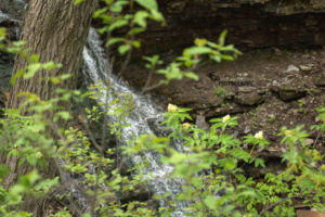
When I got back out onto the trail I noticed a woodpecker that was sitting up on a tree branch. I quickly reached for my camera and snapped a few photos before it flew away. The next stop on my hike was about halfway on the main loop trail where the Hermitage Gatehouse Museum and Cascade are located. I took a shot of the cascade and consulted my trail map to determine which direction I wanted to go in. I decided to head off the main loop trail and take the loop on the heritage trail which would take me past Canterbury Falls.
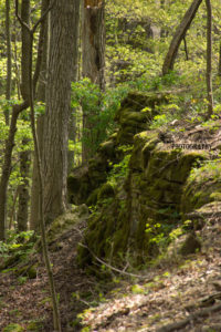
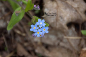
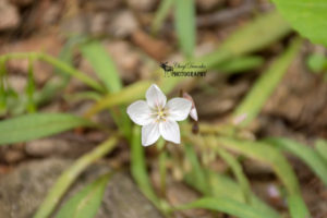
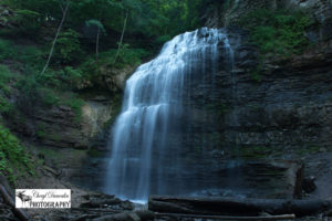
While I was making my way towards the falls, I passed several unique rock formations and saw many different kinds of wildflowers that were scattered throughout the forest floor. Finally, after coming around a bend in the trail, I had reached Canterbury Falls. Unfortunately due to the location of the falls there were tons of insects around which made it difficult to stand in one spot for very long. I took some photos as fast as I could and made my way back out onto to the trail.
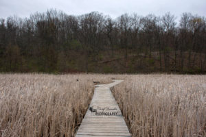
After completing the heritage trail loop, I linked back up with the main loop trail and started to make my way back towards the trail centre. The last part of my hike took me past an open field that was filled with nesting boxes where tree swallows had made their homes. When I made it back to the trail centre I took a moment to take a drink of water and then I headed back to where I had parked my car. Overall I had walked for 7 kms and really enjoyed my visit to the conservation area.
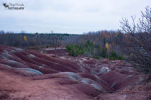
Below are the photos that I took during my hike at Dundas Valley Conservation Area.